


Central Park 12 Voting District, Grays Harbor County, Washington
About
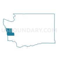
Outline

Summary
| Unique Area Identifier | 684379 |
| Name | Central Park 12 Voting District |
| County | Grays Harbor County |
| State | Washington |
| Area (square miles) | 10.64 |
| Land Area (square miles) | 10.45 |
| Water Area (square miles) | 0.19 |
| % of Land Area | 98.24 |
| % of Water Area | 1.76 |
| Latitude of the Internal Point | 46.98128450 |
| Longtitude of the Internal Point | -123.72978640 |
Maps


Graphs
Select a template below for downloading or customizing gragh for Central Park 12 Voting District, Grays Harbor County, Washington


Neighbors
Neighoring Voting District (by Name) Neighboring Voting District on the Map
- Aberdeen Ward 2 Pct 1, Grays Harbor County, WA
- Aberdeen Ward 3 Pct 1, Grays Harbor County, WA
- Central Park 10 Voting District, Grays Harbor County, WA
- Central Park 9 Voting District, Grays Harbor County, WA
- Coats Landing Voting District, Grays Harbor County, WA
- Cosmopolis Voting District, Grays Harbor County, WA
- Geissler Voting District, Grays Harbor County, WA
- Melbourne Voting District, Grays Harbor County, WA
- Sierra Voting District, Grays Harbor County, WA
- Wynoochee Voting District, Grays Harbor County, WA
Top 10 Neighboring County Subdivision (by Population) Neighboring County Subdivision on the Map
Top 10 Neighboring Place (by Population) Neighboring Place on the Map
- Aberdeen city, WA (16,896)
- Central Park CDP, WA (2,685)
- Cosmopolis city, WA (1,649)
- Junction City CDP, WA (18)
Top 10 Neighboring Unified School District (by Population) Neighboring Unified School District on the Map
- Aberdeen School District, WA (20,368)
- Montesano School District, WA (8,042)
- Cosmopolis School District, WA (2,013)